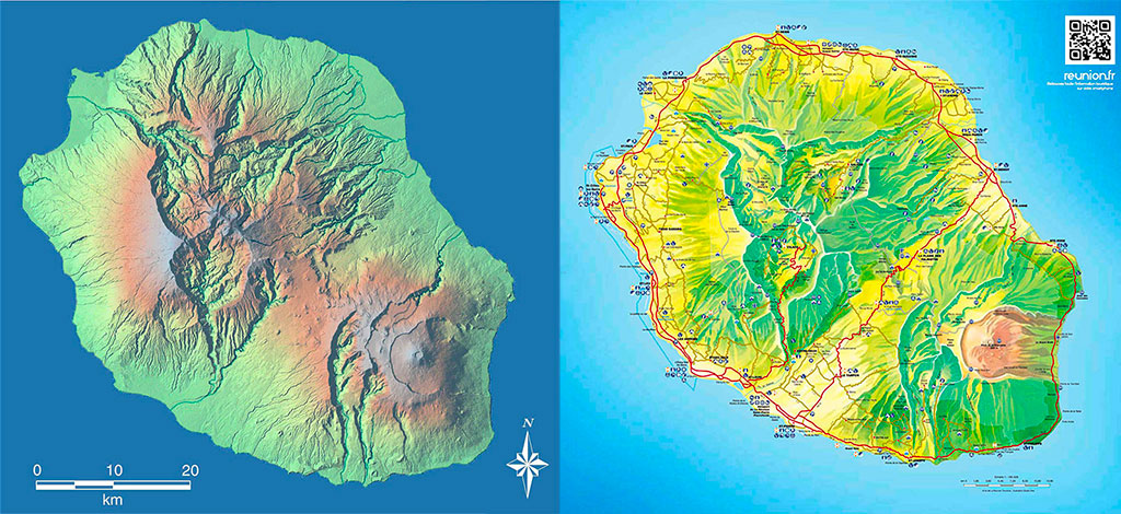
Geography and map of Reunion Island
The meeting is a tropical island with an area of approximately 2,500 km2 in the Indian Ocean. She is part of the Mascarene archipelago with the islands of Rodrigues and Mauritius.
It is an 11 hour flight from Paris, 3 hours from Johannesburg and 30 minutes from Mauritius. It's a volcanic island created 3 million years ago, by an ancient volcano named Piton des Neiges culminating at more than 3000 m of altitude.
Geography of Réunion
A second volcano, the Piton de la Fournaise still in operation, is located in the south-east of the island, and is today one of volcanoes the most active in the world. The meeting is made up of white sand beaches in the west, black sand in the southwest, small volcanic lava cliffs in the South and many plains in the east and on the heights of the island between the two volcanoes. The center houses three large circuses hollowed out by erosion and the slopes of the island are crisscrossed by numerous rivers and waterfalls.
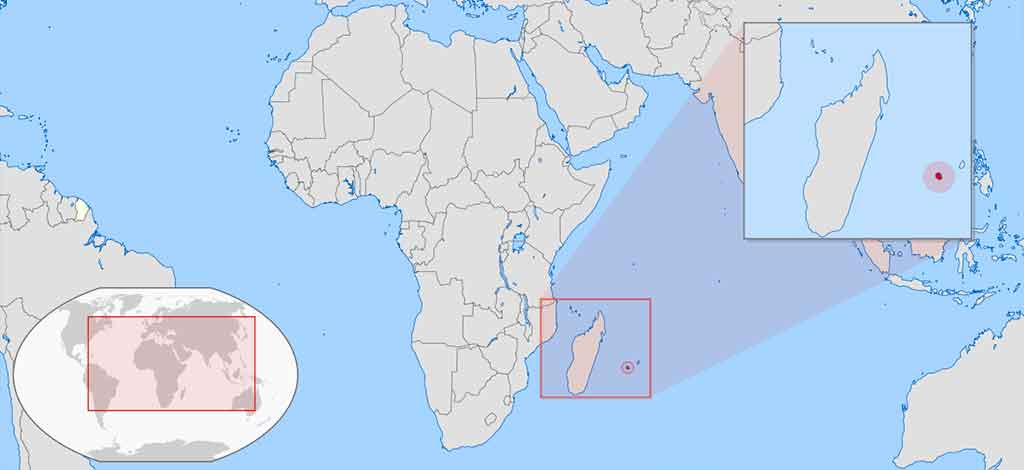
Map of Reunion on the planisphere.
The meeting enjoying a tropical climate which is very variable from one region to another due to the imposing relief of the island, is at the origin of many microclimates. Temperatures are warm on the coasts and cooler at altitude, averaging 24 degrees all year round on the coasts. There are two seasons to The meeting, the southern winter and the rainy season from January to March and the southern summer and the dry season from May to November. Check out our Meeting Guide to find out more about Réunion and click on the following link to learn more about the history of Réunion.